Sunday, October 15, 2006

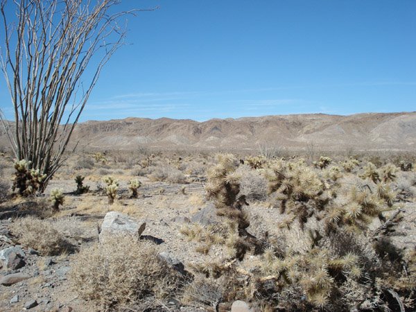
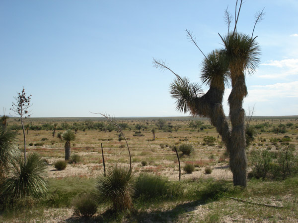
The California Coast

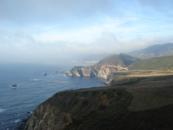
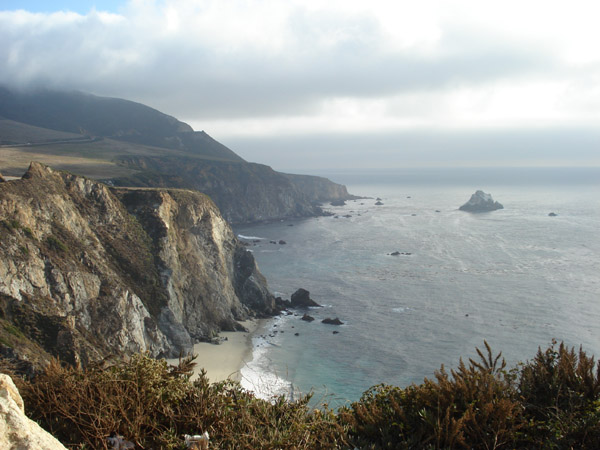
Day 100: Highway 1, CA. I guess these beautiful shots don't really need an explanation!


The Santa Ynez Valley

Day 100: Solvang, CA. Located in central California's scenic Santa Barbara County, is this Danish town which is surrounded by grape fields and horse ranches. My pictures below really don't do the town justice, it was very picturesque...felt like I was strowling around a European town.


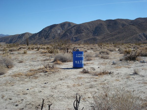
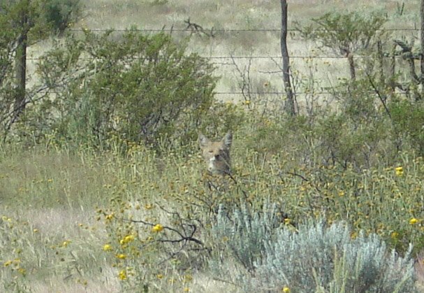
Just 3 miles to the north is the town of Buelton. You might recognize the wine-tasting restaurant below from a certain movie about a guy who loved his Pinot Noir. And I believe the Ostrich Farm had a role in that movie too...although I just can't remember when?
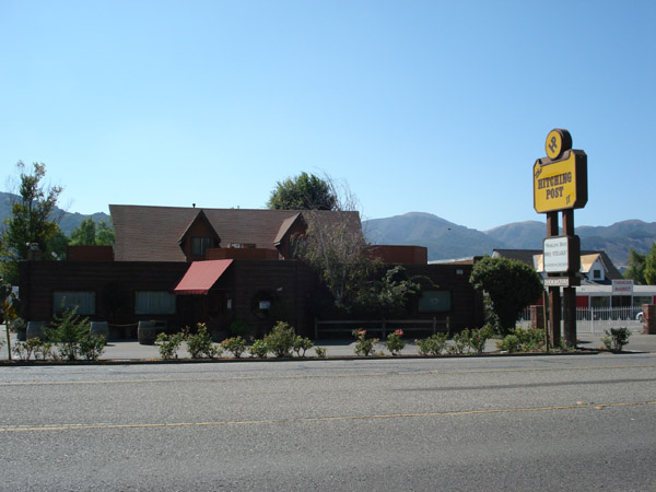
Thursday, October 12, 2006

Pink Flyod lives!!!!

Day 99: Hollywood, CA. By shear luck, my friend Dave was able to get me a ticket to the Roger Waters concert at the Hollywood Bowl. The first half of the show was classic Floyd songs and a few solo songs. After a 15 minute intermission, the entire "Dark Side of the Moon" album was played from start to finish with amazing detail to the original. An encore with a few songs from "The Wall" came next and "Comfortably Numb"(my favorite Floyd song) closed the concert.

It's difficult to put into words just how amazing this concert was! In fact I haven't seen a show this intense since Pink Floyd's 1993 Division Bell Tour(and that was with David Gilmour on vocals). I tried to take some pictures, but you can see they are pretty blurry...it was too dark to take decent shots. If you're a fan of Pink Floyd the flying pig needs no explanation(although it this time it was covered with a bunch of political messages).

During "Eclipse", the last song on the album, a giant triangle floated above the Bowl and then emitted lights that recreated the legendary album cover of "Dark Side of the Moon". It was totally unexpected and brilliantly played out. Unfortuanately you can only see the triangle in the photo.


Tuesday, October 10, 2006

America's greatest town!!!

Day 94: Manhattan Beach, CA. I lived in this town for only 6 years before moving out to Dallas, but I will forever refer to it as "home"! As expected, the weather was perfect and the colors in the town dazzled my eyes! Also as usual...Tom Daniels enjoyed the week!!!


Friday, October 06, 2006

Southern California Desert

Day 90: Anza Borrego Desert. Shortly after crossing the border into California, highway 10 passed through the Imperial Sand Dunes Recreational Park. There was nothing but pure white sand dunes in all directions. It's hard to tell in the photos, but the dunes must have been at least 200 feet high. I could see people walking up to the top and others skiing or "snowmobiling" down them. I totally regret not walking up to the top...the view was most certainly desertacular!

I decided to make the trip through the desert more interesting by getting off the main highway to drive a road named S2. Appartantly no one else decided that road was worth driving. The next three photos were taken at the Carrizo Badlands Overlook. The drive on S2 was long(and winding sometimes). I didn't see any desert animals...only 50 gallon drums of water every few miles!


Wednesday, October 04, 2006

Hueco Tanks Historic State Site

Day 89: El Paso, TX. Just west of El Paso is a pretty amazing state park. Because it has been given a historic status, they only let 70 people into the park at one time. The day I visited there was only one other person beside myself. The park is named so because of bowl-shaped caverns that have been carved by erosion in the rocks. Some of these "huecos" are still filled with water, even during the hot desert summers.


Besides huecos, this park is also famous for indian pictographs. I was given a descriptive map that showed and explained reference points for climbing the mountain(there were no marked signs or trails to follow). The ranger made it sound pretty simple and straight-forward, but it was difficult orientating myself on the rocks. Two key points of reference were the rock formations resembling a duck and a crocodile. They look very obvious in these photos, but finding them was not easy...especially the crocodile which was a pretty good hike away.


Eventually I did find the cavern, but it was a very tight squeeze to get in. I had to get on my belly and crawl through a crack that was less than two feet tall. I remembered hearing the ranger say that I would have to "spider" my way through it! :( About 15 feet in, the cavern opened up to about 4 to 5 feet high. Inside was 8 face-mask drawings. One of them kind of reminds me of Carl Weezer.


After checking out those indian drawings, I decided to go check out some more that were closer and would be easy to find. As you can see all of the "easy-to-find" drawings have been vandaled over the years. It was actually difficult to see the drawings with all the grafitti directly on top of them. I was surprised to see that some people had signed their names...in the late 1880's!


A lonely desert road!

Day 89: near El Paso, TX. I drove Ranch Road 1111 for at least an hour and a half(probably around 80 miles long) and didn't pass a single other person. The cacti that grew in this area at times resembled animals grazing in fields. I was thrilled when I got to see a fox(or similar animal) cross the road. You can just see his head popping out of the grass in the last photo.


Big Bend National Park

Day 88: Big Bend, TX. This enormous national park can be found in southwest Texas bordering Mexico on the Rio Grande. Not only did I find the natural formations spectacular, but I only saw a couple of other cars there in the 2 to 3 hours I spent exploring.


At one point I came across a family of javelinas(furry pig-like animals) crossing the road. I had to come to a complete stop so that all of them(around 8) could finish their crossing. When the last one was almost off the road, he stopped and looked back at me and shot me a dirty look.


The next two photos were taken at the border between Mexico. The Rio Grande River has carved these rocks over thousands of years. The foreground (with all the shrubs) is actually the river. You can’t see any water because the summers are very dry. I found the site of this wall of rocks to be very eerie. Not only is it coincidental that a huge wall just happens to be the border of our country, but the size was staggering (probably 300 to 500 feet high).